

The NISAR satellite — a joint project of NASA and the Indian Space Research Organisation (ISRO) — has captured radar imagery of an agricultural area in the northern part of South Africa’s Free State province, covering a full growing season from November 2025 through March 2026. The data obtained were used to create a multicolor visualization reflecting the condition and dynamics of crops throughout the entire season. This was reported in a NASA Earth Observatory feature.
The “Maize Triangle” and Its Agricultural Significance
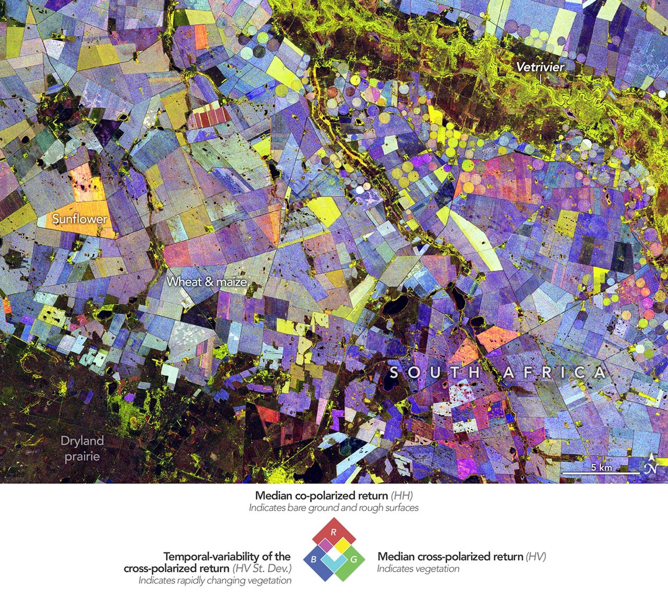
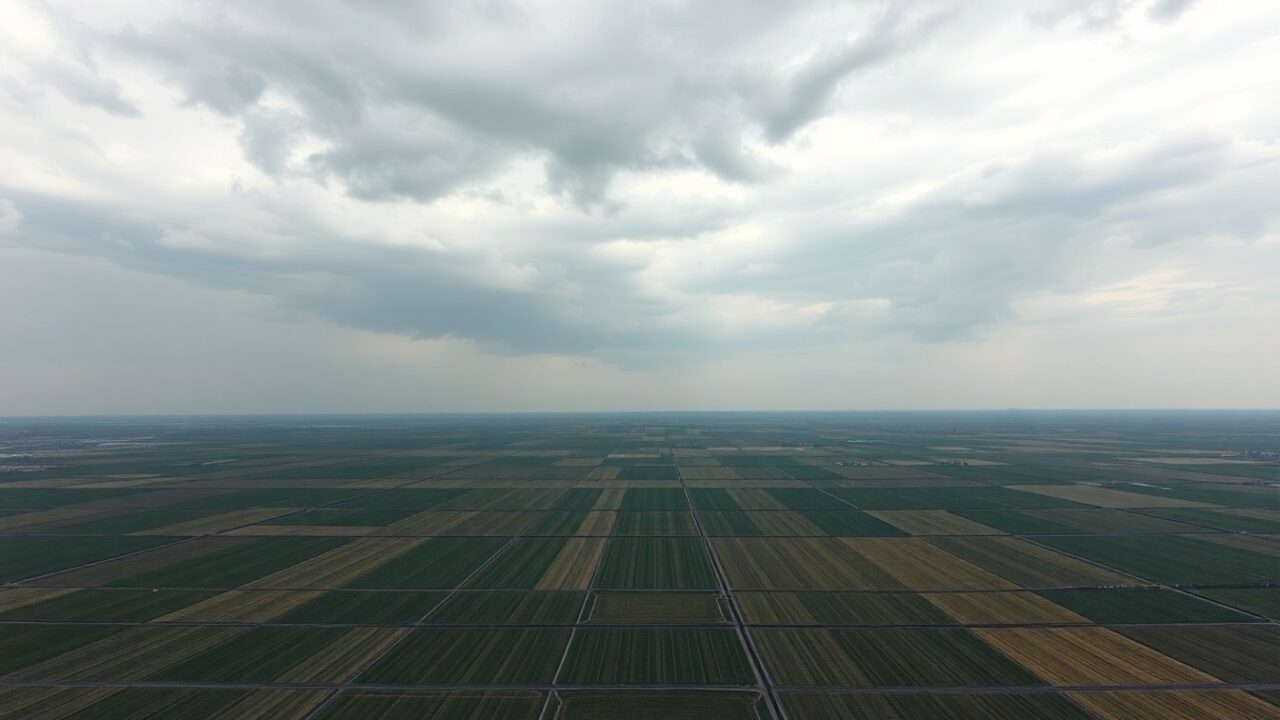
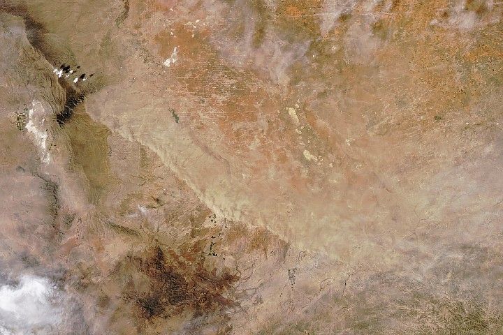
The imaged area is located approximately 110 kilometers north of Bloemfontein, along the Vet River. Here, in the semi-arid part of Free State province, river water irrigates fields planted with a variety of crops. The region is part of what is known as the “Maize Triangle” — a zone encompassing the North West, Free State, Gauteng, and Mpumalanga provinces, which accounts for the bulk of the country’s maize production.
The imagery clearly shows the circular fields characteristic of irrigated farming — the result of center-pivot irrigation systems — interspersed with rectangular plots. The combination of geometric shapes and a rich color palette gives the image a resemblance to abstract painting, yet each color carries specific physical information.
How the NISAR Satellite Works and What the Colors Mean
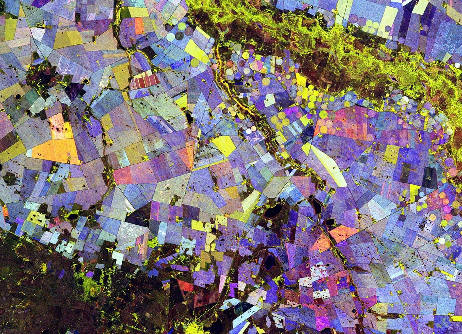
The data for the visualization were collected during 10 passes of the NISAR satellite over the area between November 2025 and March 2026. The spacecraft uses an L-band radar capable of “seeing” the structure of vegetation rather than its color. The radar signal is directed toward Earth’s surface, and the character of its reflection is then measured — including the polarization of the returning waves, which carries information about plant and surface structure.
Statistical indicators for each pixel, calculated from multiple observation dates, were combined into a single composite image. The resulting false-color visualization uses the following color coding:
- Green — presence of vegetation cover;
- Red — absence of vegetation (bare surface);
- Blue — rate of change in vegetation cover throughout the season.
Since most pixels contain a mixture of these characteristics, the resulting palette is rich and varied. For example, stable vegetation — such as forested areas — produces a light blue hue. Crops that change structure during the season, such as wheat and maize, appear as a darker blue. Fields where plants rapidly accumulate green biomass and are then harvested early take on an orange color — behavior characteristic of sunflowers in this region, although, as the feature notes, ground-truth verification is required to confirm specific crops on individual fields.
Scientist’s Commentary: What the Data Reveal
“It’s a beautiful image, but it’s also telling us important things,” NASA quotes Paul Siqueira, a scientist at the University of Massachusetts Amherst and ecosystems lead for the NISAR science team. According to him, crops such as maize and sunflowers look different in NISAR imagery than forests do — owing to differences in plant size and growth periods.
The data processing method itself is described in the feature as relatively straightforward, yet it is underpinned by a substantial body of information accumulated over several months of observations.
NISAR: Objectives and Monitoring Prospects
The methodology developed makes it possible to track crop development, the effects of irrigation, and land-use changes across large areas in a reproducible manner. As the NISAR satellite continues to accumulate data, researchers plan to compare indicators across different seasons, document differences in growth dynamics between individual fields, and study how agricultural systems respond to water availability and climate variability. Similar approaches to agricultural data analysis are already being applied in other regions — for instance, AI in agriculture is helping to determine optimal harvest timing.
The visualization was prepared by Paul Siqueira (University of Massachusetts Amherst) using data from the NISAR GCOV product; the NASA Earth Observatory feature was produced by Michala Garrison, with text written by Katherine Hansen.
What Is NISAR
NISAR is a joint mission of NASA and the Indian Space Research Organisation (ISRO). The satellite is equipped with a synthetic aperture radar (SAR) and is designed for systematic observation of Earth’s surface. The L-band radar used in this study is capable of penetrating vegetation cover and capturing the structural characteristics of crops — unlike optical instruments, which operate only in cloud-free conditions and during daylight hours. Other areas of space technology are also advancing in parallel: for example, space robotics is reaching the commercial level, opening new possibilities for orbital missions.
The image covers the period from November 22, 2025, to March 10, 2026, and represents a composite image constructed from data collected during ten passes of the spacecraft over the Vet River area in Free State province.
Источник: NASA Breaking News


Comments on this article